|
|
|
|
WGMCo. Water Race |
|
|
|
Mill Stream Walkway Historic FeaturesMill Stream Water Races
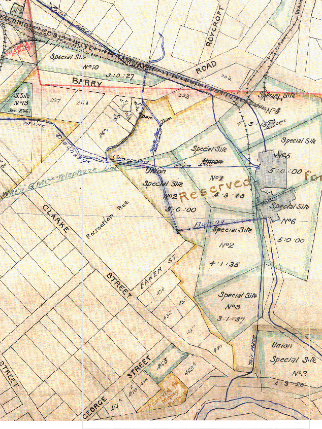
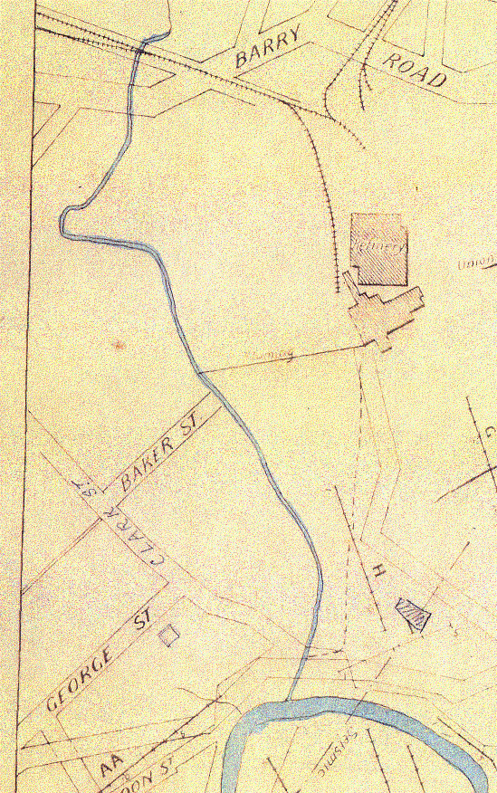
WGMCo. Water RaceMap 3 and 4 The Waihi Gold Mining Company took over the Cassel race when relinquished by the Cassel Company. The WGMCo. continued to operate the Cassel tailings plant for a time on their own account, and at about this time built a prominent wooden flume across their tailings ponds to the battery. This is visible in many of the photographs of the Waihi Battery. The fluming took water from the race close to the end of Baker Street, and delivered it to the Pelton wheel shaft at the battery buildings. At some stage, prior to 1906 (photo c.1906), the mine discharge water was channelled directly to the race near the Battery Manager’s house, thus possibly making redundant the diversion. The Borough Council map still shows the diversion, but with a dam on it close to Barry Road. The section from the reservoir is labelled as Cassel Race Waihi GMCo Ltd. It is denoted on the map by a single line, whereas the ground channel is shown by two lines. The Cassel section appears to have been piped over a trestle (old photos). The informal roadway in Morgan Park, beside the driveway to the old house, marks the position of this race. The 1942 aerial photograph shows that the water race channel still existed, and that a bridge crossed it from the old house to the Recreation Ground (as Morgan Park was then called). By-wash A by-wash for this race was created across the end of Baker Street, and down the edge of "Pylon Paddock". The top section of the by-wash was constrained within a wooden flume, but further down in an open ditch which still exists. The by-wash took excess or unused water from the water race, to stop it over flowing. The by-wash discharged into the drain behind Charlie’s seat (part of the cut-off drain system). One old map denotes Mill Stream as being the diversion, the mine discharge "short-cut", the race beside the house driveway, the by-wash, and then the drain and present stream position (which was the old cut-off drain)! What is confusing is that this map has water flowing east to west in the diversion, whereas our earlier discussions require it to flow west to east (from adit discharge to Mill Stream).
|
|
Waihi District Walkways Inc. PO Box 241 Waihi New Zealand Send e- mail to: Waihi Walkways |